Ancestral Footprints of the Grand Canyon National Monument Safeguards Public Lands Against Uranium Mining Threats
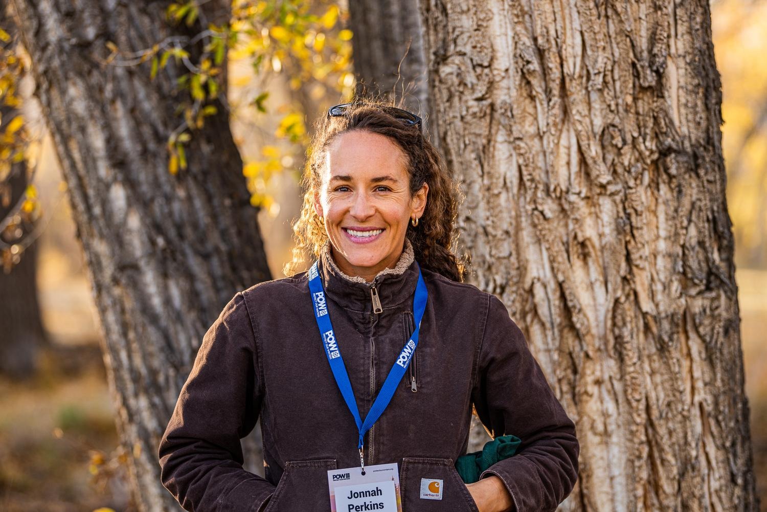
Photos by Len Necefer and Jonnah Perkins
On August 8, President Joe Biden designated the Baaj Nwaavjo I’tah Kukveni – Ancestral Footprints of the Grand Canyon National Monument that aims to conserve and protect close to 1.1 million acres of BLM and US Forest Service lands surrounding the Grand Canyon.
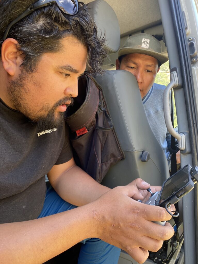
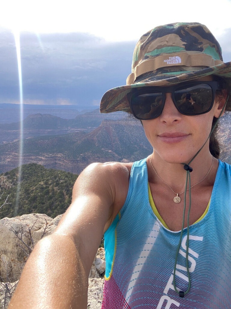
This announcement came just one week after I returned from the region on a field journalism assignment with fellow POW Athlete Alliance member, Len Necefer, and photographer, Mylo Fowler, both members of the Navajo Nation. Supported by Trout Unlimited, our team was on the ground for almost a week documenting the proposed monument and the critical need for protection of the region.
The land that is now protected under the recent designation has been qualified by mining prospectors as wasteland, scrubland, uninhabitable, and therefore ripe for mineral extraction, primarily for its rich uranium deposits. The legacy of the uranium mining and subsequent environmental abuses in this region at the expense of Indigenous communities and wildlife habitat are vast. Ahead of our trip Len wrote about this on his Substack which gets to the downstream issue of the greater Colorado River and the lower basin states that rely on this water.
From Len’s Substack ALL AT ONCE:
“Lands around the Grand Canyon and the Four Corners region are rich in Uranium deposits and have been the site of significant mining during the cold war. Increased efforts to address national security concerns around mineral supply chains have increased the drumbeat to onshore more mining activities in the United States. This hasn’t sat well with the many tribes that call this place home. The impacts from increased uranium mining in this region will potentially impact cultural sites, but more importantly, this region sits within the watershed that feeds the Colorado River. Let us not forget that 40 million Americans are downstream from the Grand Canyon – looking at you, California and Arizona.”
The Havasupai tribe, with many tribal members living within the Grand Canyon, have taken tremendous leadership in protecting their home as well as amplifying the message around the greater threats that our nation faces from uranium mining. Len, Mylo, and I had the honor of interviewing two tribal leaders to talk about why the designation is such an important political lever in protecting water sources, wild game, and the dignity of their relationship to the land. Stuart Chavez and Dianna Sue White Dove Uqualla, former and current tribal council members for the Havasupai tribe, sat down with us to talk about the urgency of pushing this national monument designation forward.
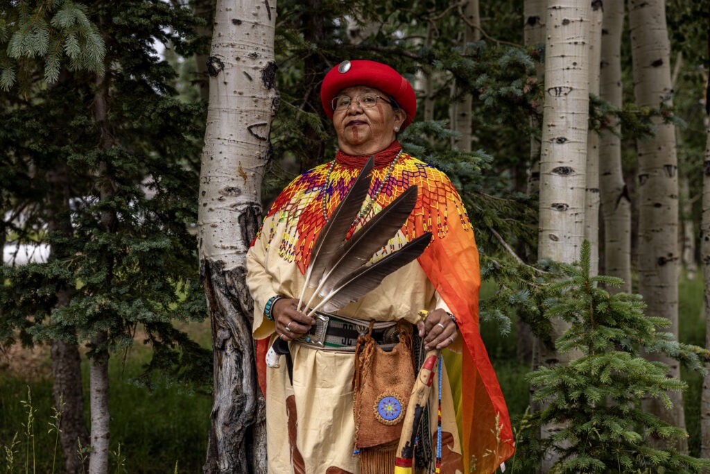
Dianna spoke about the power of water and its inability to be contained, especially in the context of water being exposed to uranium mining activities, “You can’t stop water. If it wants to come, it’s going to come. It’s already getting contaminated, they don’t seem to understand that. It’s not a sickness where you get shot, and you can die easily. Once the uranium is being digested by animals, birds, human beings, or even by the breath you take, it goes inside your body, and you may not get sick right away, but it’s your offspring that are going to pay for the sickness. Each generation is going to get worse as they reproduce. And the world will never be the same.”
As a former Havasupai anti-uranium subcommittee member, Stuart has been instrumental in the shaping of the dialogue around the importance of the national monument designation. “It’s unfortunate that the individuals who this land was stolen from in the name of preservation have to be the ones who are actually protecting it from the people who are supposed to be protecting it,” Stuart explained the irony of the Indigenous-led effort to not only protect waters close to the source of contamination but also being the strongest voice in protecting those who are relying on Colorado River water downstream. “We’re going to be the first ones that are going to be impacted. We may be impacted first, but from there, it moves on down into the Colorado River. Many people within the Flagstaff and Phoenix Metropolitan Area benefit from water as well as the Western region of the United States.”
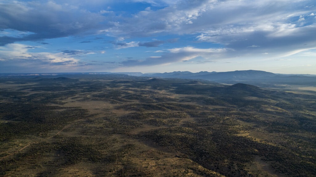
A lot of my work as a journalist has focused on the ecological, economic, and public health fallout from natural resource exploitation on land and in water systems. The most important thing I have learned over the years is that the “resources” that humans attempt to harness – water, wind, seeds, animals, soil, minerals, sun – don’t follow lines on a map – and neither did our team while we were capturing this story. One of the most important tools we had was Len’s aerial photography for getting on top of the active and dormant mining sites that were hard to see from ground level.
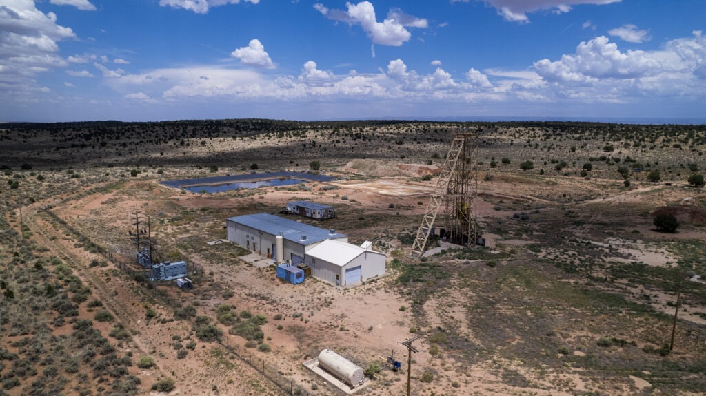
Driving hours to reach a mining site then be separated by chain link fence surrounded by trail cams, Len’s drone was so critical in our reporting on the issue from above. “The remoteness of these mines has kept them out of the public eye. In my head I kept thinking, “Out of sight, out of mind”. Hopefully showing what these mines look like and where they are will help bring more creedence to why this area needs protection. These mines sit right above the drainage into Hack Canyon, which feeds into Kabab Creek, and then into the Grand Canyon,” Len wrote on his Substack.
Much of the damage that is done through mineral extraction outlives the life of the mines themselves. Storing radioactive uranium slurry requires ongoing monitoring as retention ponds can fail and seep into the subterranean water systems. Waste water runs downstream and impacts humans, fisheries, livestock, and wild game, all with broad implications across many outdoor pursuits. As horrifying as the sites looked from above, the real devastation is actually out of sight – below ground in the porous rock that funnels water directly into streams and then into the Colorado River.

On the last day of this trip, Len and I dropped in on river guide and local business owner, Brady Black. Brady and his wife own Lee’s Ferry Lodge at Vermillion Cliffs in Marble Canyon which backs up to Vermillion Cliffs National Monument. The lodge is a few minutes from the Lee’s Ferry Colorado River kayak and raft launch site. Brady has been a long time advocate for protection of the region and the communities it supports. He sat down with us to share his story before telling us that we should get on the river with him instead of just talking about it.
“Our water comes out of the cliffs and we hike up an old uranium road to fix our water line. That was probably my first real realization for the mines here in Marble Canyon. I started to discover what those roads were for and what was at the end of them. What I learned is the tragic history of the Navajo Nation and uranium. And also the impact on the Grand Canyon,” Brady told us as we sat around his dining room table. “As a business owner working in recreation, I learned about two uranium mines on either side of the river. I always wondered why have a uranium mine in such a fragile area when there is unlimited potential for uranium somewhere else? When you mine uranium, so close to a water source, you are putting that water source in danger.”
The uranium industry has made statements that responsible mining practices are possible without harming the land or contaminating groundwater despite a history of wastewater containment failures. With the push for a decarbonized energy grid, uranium plays a critical role in nuclear energy, which is arguably our cleanest long term energy solution. This was a major conversation that Len, Mylo, and I had during our time on the road and on the trail. What we all agreed on is that minerals must be extracted to power our energy needs, but the cultural, historic, environmental, and ecological context must be considered above all else. Under this national monument designation existing rights, livestock grazing permits, and mining claims within the monument boundaries are recognized but no new future mining leases will be granted.As I was packing up to make my way back to the Midwest, Len explained why casting a larger buffer around the Grand Canyon is so important to the hydrology and geology of the area that until now has been a patchwork of land classifications. “This monument is making a continuous ecosystem that surrounds the Grand Canyon, because animals, plants, and water don’t look at the boundaries on the map and say, ‘oh, Grand Canyon, we can’t go there because I’m toxic.’ These parcels are really important to the ecological integrity of the Grand Canyon.”
Author: Jonnah Perkins
Jonnah Perkins is a trail runner, writer and activist based in southwest Wisconsin. She found trail running after the birth of her first child and was soon podiuming ultra-distance races across the country. Perkins is also an organic farmer and has been working alongside her family for over a decade. Through her work in agriculture, […]
